It provides a single user interface in working with the output of different (hydro-morphodynamic) simulation software. Digitalys is fast, can generate videos and helps you check your results.
Supported simulation output
- Deltares
- D-Flow Flexible Mesh
- SOBEK2
- Delft3D4
- DelWAQ
- XBeach
- SFINCS
- Delft Flooding System (FLS)
- TUFlow
- XMDF format
- DHI
- MIKE structured
- MIKE unstructured
- Nelen & Schuurmans
- 3DI
- TU Delft
- SWAN
- SWASH
- US Army Corps of Engineers
- HEC-RAS (2D)
- Flowscience
- Flow-3D
- GIS formats
- GeoTIFF
- Shapefiles
- Geopackage
- GeoJSON
Automatic post-processing
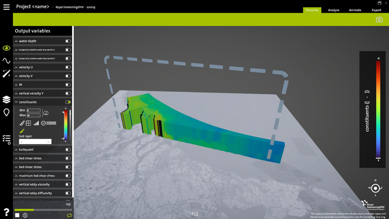
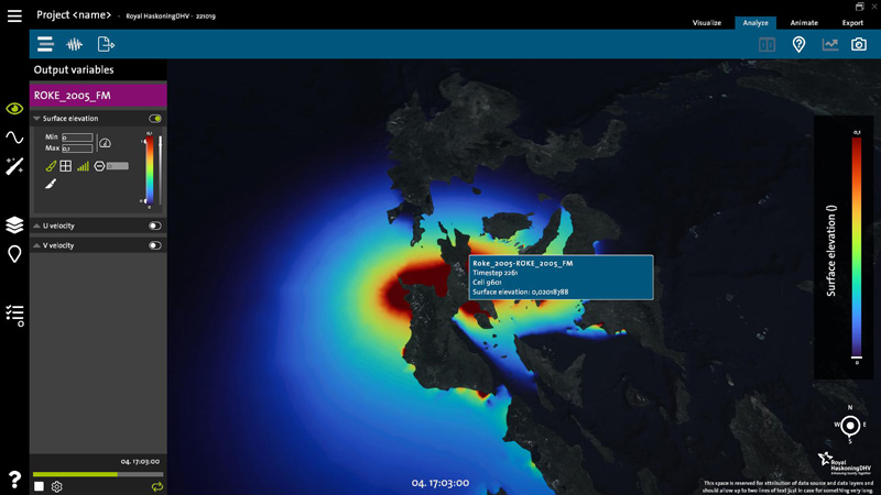
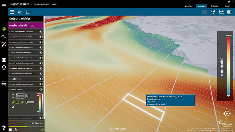
A variety of variables are automatically detected in the output files. Digitalys will then automatically add additional variables to the special post-processing list.
For example, if velocity components are detected you will get the option to display arrows and flowlines! If water depth is present, you will also immediately get access to total inundation time, time of flooding, maximum depth in the simulation, etc.
Export to GIS formats
Digitalys also serves as an intermediate tool for additional processing. It allows export to Shapefile and CSV formats for additional processing in Microsoft Excel, Python or Matlab.
More information
Digitalys is currently in development by Haskoning as part of the Digital Way of Working (DWOW). For more information get in touch with almar.joling@haskoning.com
Downloading Digitalys
Please send an e-mail to request a version of Digitalys*. Currently Digitalys is a tool in development and we might or might not consider offering an official (external) release. Currently we are using it for our (Haskoning) own visualizations and therefore Digitalys is provided "as-is", with no guarantees of working correctly with all models and/or promises of any support.
Versions of Digitalys are always time limited (more so to make sure everyone updates once in a while).
* we expect you to mention Digitalys in produced visual materials, at the bottom-right there is automatically a small attribution visible.
Employees of Haskoning can download Digitalys directly.
If you are an employee, get your copy of Digitalys here.